High Country. Three Possible Homes.
The selected warm farm landscape, reimagined in three distinct parts of Forge Island. Click any image to inspect its original in ForgeMedia.
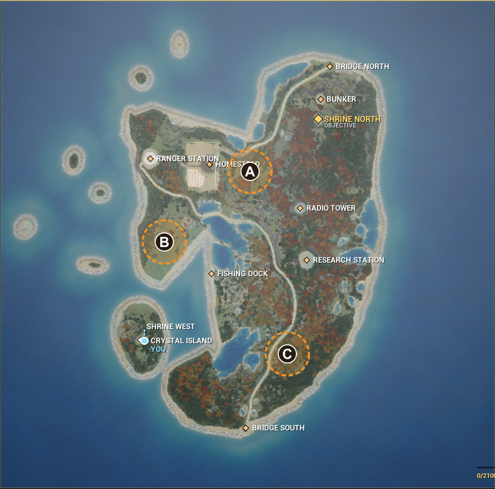
RECOMMENDATIONStart With A — Homestead East
The strongest functional fit: extend the island’s agricultural district rather than introduce a second isolated farm. Keep the existing yard and hero field intact; fit the new meadow beside them.
A · Homestead East
Best first study: ties into the existing farm district and nearby road, with wooded separation from the established yard.
Trade-off: Check the existing hero-field boundary, terrain relief and training-site reservations before choosing a footprint.
Inspect drone concept ↓B · Western Inlet Terrace
A distinct waterfront destination on the western finger, with the inlet giving the meadow a strong natural edge.
Trade-off: Narrower landform: likely the most compact layout, with new access and careful shoreline setbacks. Do not occupy the Bayside Convention Center reservation.
Inspect drone concept ↓C · Southern Lake Terrace
Strongest quiet retreat: the southern lake and surrounding forest echo the source landscape while keeping it apart from the busy farm district.
Trade-off: Woodland clearing and slope grading would need testing; keep the main north–south road continuous and retain a lake-edge buffer.
Inspect drone concept ↓Map: archived Unreal capture from ForgeMedia, cropped without regenerating its geography. North is up. Dashed circles are search areas, not surveyed boundaries or confirmed available parcels. Later additions, including Bayside and training sites, must be checked against the current build.
A · Homestead East
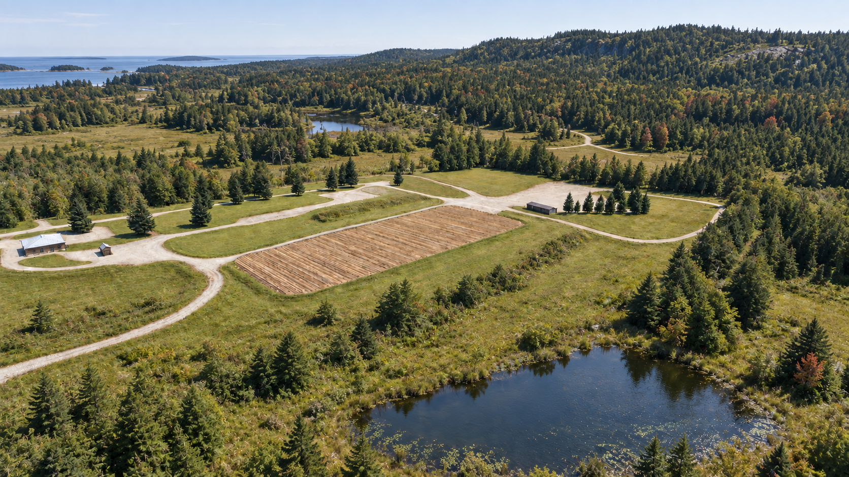
Best first study: ties into the existing farm district and nearby road, with wooded separation from the established yard.
Field, curving paths, low buildings and pond preserve the source’s identity; surrounding terrain and unseen details are generated interpretations. Native image: 1672 × 941. Camera altitude and footprint are illustrative, not measured.
Open original in ForgeMedia ↗B · Western Inlet Terrace
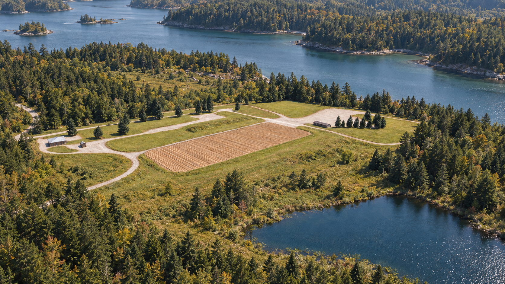
A distinct waterfront destination on the western finger, with the inlet giving the meadow a strong natural edge.
Field, curving paths, low buildings and pond preserve the source’s identity; surrounding terrain and unseen details are generated interpretations. Native image: 1672 × 941. Camera altitude and footprint are illustrative, not measured.
Open original in ForgeMedia ↗C · Southern Lake Terrace
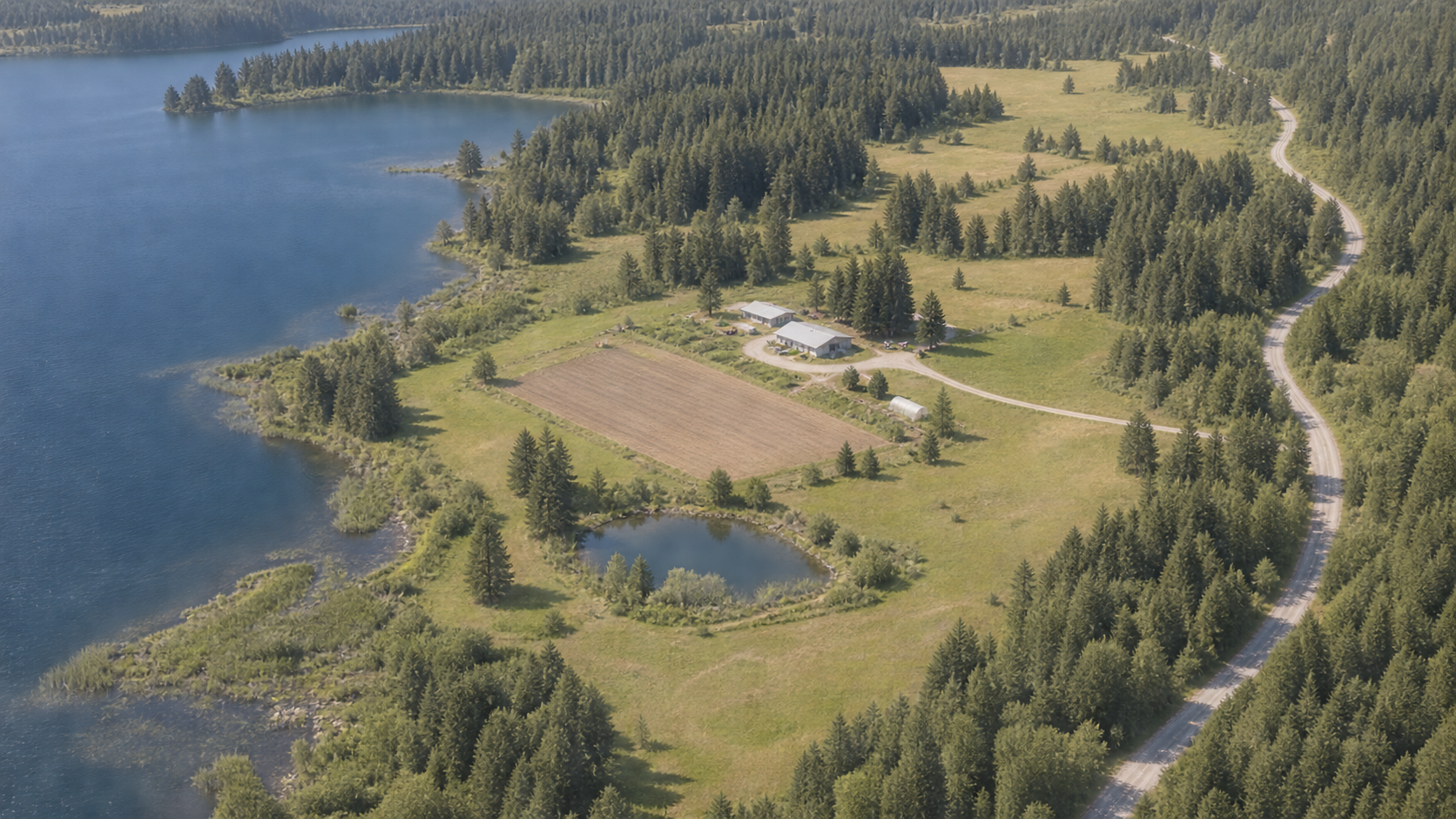
Strongest quiet retreat: the southern lake and surrounding forest echo the source landscape while keeping it apart from the busy farm district.
This option rearranges the source farm most, and moves the road to the outer edge in the visualization. A literal fit at the marked area needs a terrain/road-layout study. Native image: 1672 × 941. Camera altitude and footprint are illustrative, not measured.
Open original in ForgeMedia ↗Sources & All Intermediate Images
Every new visual intermediate and the three final concepts are preserved in ForgeMedia. Source originals remain unchanged.